Zion's most famous trail is a river, and another one needs a lottery permit before you can climb it. In a park this crowded, how good your day is depends mostly on timing. Instead of going spot by spot, this guide follows one day hour by hour: three things to do the night before, the 6:30 a.m. parking battle, the first 7:00 shuttle, the Narrows first, Angels Landing at midday, Emerald Pools and a Watchman sunset in the afternoon, and why you shouldn't wait for the last bus. Plus: how to adjust by season, a second day on the East side and in Kolob Canyons, three plans for three kinds of travelers, where to stay, how to get there and where to charge an EV.
Key facts
- The best Zion experience isn't any single sight. It's getting the timing of the day right: enter the lottery and check the river the night before, go to the far end first, climb at midday, slow down in the afternoon, and don't wait for the last bus.
- The Narrows or Angels Landing — which would you do first? Tell me in the comments. And if you've already been, leave the mistakes you made, so the next person can skip them.
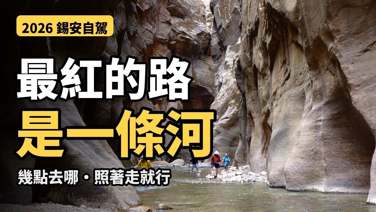
▶ Watch the video · YouTube
First, the shape of Zion
Before we start, take one minute to understand the map.
Zion was Utah's first national park, established in 1919. When most people say Zion, they mean Zion Canyon in the south, where the Virgin River runs north to south between red and white walls hundreds of meters high.
At the canyon's south end are the Visitor Center and the South Entrance, with a small town right outside called Springdale.
From the middle of the canyon, a winding road heads east through an old tunnel to the East Entrance. If you're driving from the Grand Canyon, that's most likely how you'll come in.
And there's a part many people don't know about, in the northwest: Kolob Canyons. Its entrance is right off Interstate 15. It isn't connected to the main canyon, so you drive there separately. We'll save it for day two.
The night before: three things to do in advance
A lot of people only realize once they're in Zion that the most important things should have been done the day before.
One: the Angels Landing permit. Besides the big seasonal lottery, there's a day-before lottery. Apply online the day before your hike, between midnight and 3 p.m. Mountain Time, and results come out at 4 p.m. The application fee is six dollars, non-refundable, plus three dollars per person if you win. One application covers up to six people.
Two: check the Narrows. If the river flow goes over 150 cubic feet per second, the whole Narrows closes. It also closes whenever a flash flood warning is issued, and stays closed for at least two hours after the warning is lifted. So the night before, check the park website for river flow and the forecast.
Three: decide where you'll park tomorrow. That one, we'll run into at 6:30 in the morning.
6:30 a.m.: the parking battle
In peak season, the Visitor Center lot is often full by eight or nine in the morning. Once it's full, you have to turn around and drive back into Springdale.
Springdale has plenty of paid lots. Park, then take the free town shuttle, roughly every ten to fifteen minutes. It drops you at the park entrance, and the Visitor Center is a short walk in.
An easier option: stay in Springdale and walk to a town shuttle stop. Then you don't have to fight for parking at all.
7:00 a.m.: the first canyon shuttle
During shuttle season, private cars can't drive the Zion Canyon Scenic Drive. You take the free shuttle, no reservation needed.
From now until November 28, the first bus leaves the Visitor Center at 7 a.m., and the last bus into the canyon leaves at 5 p.m.
The canyon line has nine stops. One detail to remember: Stop 2, the History Museum, Stop 3, Canyon Junction, and Stop 8, Big Bend, are served only on the way down. Heading up the canyon, don't wait for those.
Bikes are also allowed on the Scenic Drive, and shops in Springdale rent bikes and e-bikes. The big advantage is freedom: stop wherever you like. The one rule: when a shuttle comes up behind you, pull over and let it pass.
Today's plan is to ride all the way to Stop 9 first, then work our way back stop by stop. Early in the morning, the quietest place is the far end.
7:40 a.m.: Stop 9, into the river
Stop 9 is the Temple of Sinawava. From the bus, start with a paved riverside path called the Riverside Walk, about a mile one way. It's flat, even stroller-friendly. Early in the morning you'll often see mule deer grazing by the river along here.
At the end of the path, the trail simply stops, and in front of you is the Virgin River. This is where the real Narrows begins.
The farther upstream you go, the closer the walls get, until all you see overhead is a strip of sky. After two or three hours you reach the narrowest, most famous section, which people call Wall Street.
Going bottom-up as far as Big Spring needs no permit. That's about ten miles round trip, and walking in water is far more tiring than a mountain trail. Most people turn around after an hour or two, and it's still completely worth it.
If you want to hike the entire Narrows from the top down, that's a different trip that needs a wilderness permit in advance, so we won't cover it today.
Gear: the rocks in the river are round and slippery, so wear closed-toe shoes and carry a sturdy hiking stick. Sandals, Crocs and bare feet are not a good idea.
It's fall now, and the water is already getting colder; in winter and early spring it's colder still. Shops in Springdale rent water shoes, neoprene socks, and waterproof pants and jackets.
Two safety notes. First, the river may contain toxic cyanobacteria: don't drink the river water, don't put your head under, and keep a close eye on kids. Second, if the weather looks wrong, don't go in. With high walls on both sides, heavy rain can raise the water in a very short time, and there's nowhere to climb to.
Out of the river, our next stop has a section less than a meter wide.
11:00 a.m.: Stop 6, Angels Landing
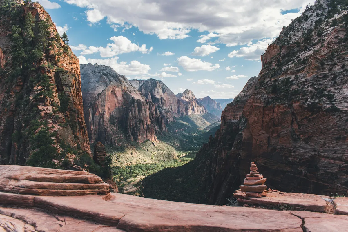
Back on the bus to Stop 6, The Grotto. The Angels Landing trail starts here.
The name has a story. Over a hundred years ago, someone looked at this rock and said something this tall and this isolated was a place only an angel could land. The name stuck.
The full hike is about 5.4 miles round trip, with roughly 450 meters of elevation gain. It usually takes about four hours.
The first part is the West Rim Trail, switchbacking up the cliff. Near the top is a set of 21 tight switchbacks squeezed into a narrow cleft, called Walter's Wiggles. After those you reach Scout Lookout. Up to here, no permit is needed.
Beyond Scout Lookout is the famous final half mile: the ridge is less than a meter wide in places, with sheer drops on both sides and only a chain to hold. From here on you must have a permit, and rangers can check it anywhere on the trail at any time.
Didn't win the lottery? Don't be disappointed. The view from Scout Lookout is great on its own, and you can sit there and watch people inch their way along the ridge.
When you eat at the lookout, squirrels will come right up to you. Don't feed them. They really do bite.
December 1 through the end of February is the winter permit season. The ridge can ice up in winter, so even with a permit, if conditions are bad that day, turn back.
1:00 p.m.: Stop 5, Zion Lodge and the Emerald Pools
One stop down is Stop 5, Zion Lodge. It's the only lodging in the entire park, and the easiest place for lunch. There's a big lawn out front where lots of people rest in the shade.
After lunch, the Emerald Pools trail is right across the road. Lower Emerald Pool is 1.2 miles round trip, about an hour, with a small waterfall spilling off the cliff. If you've still got energy, keep going up to the Middle and Upper Emerald Pools.
A small tip: from the Emerald Pools, the Kayenta Trail takes you straight back to Stop 6, The Grotto. That way you don't retrace your steps, and you link the two stops in one walk.
Note that swimming isn't allowed in the Emerald Pools, and in winter the trail can be icy.
3:00 p.m.: Stop 4, Court of the Patriarchs
Stop 4 is the Court of the Patriarchs. A few minutes' walk from the bus is a viewpoint facing three peaks side by side, named after the three patriarchs of the Bible.
You don't need long here. Ten minutes for photos is plenty. In the afternoon light, the rock looks warmer than in the morning.
3:30 p.m.: the two down-canyon-only stops
Next come the two stops served only on the way down.
Stop 3, Canyon Junction, is where the winding road to the east splits from the Scenic Drive. The riverbank near the junction is one of Zion's classic sunset photo spots, looking out at the Watchman. In the evening it's lined with tripods.
Stop 2 is the Human History Museum. There's a film about Zion inside, a good chance to rest your legs. Behind the museum is a row of peaks called the Towers of the Virgin, which look beautiful in afternoon light.
4:00 p.m.: back at the Visitor Center, saving it for sunset
Back at Stop 1, the Visitor Center, you have two options for the afternoon.
For something easy, take the Pa'rus Trail. It follows the river for 3.5 miles round trip with almost no climbing, all the way to Canyon Junction. It's also the only trail in Zion where bikes and leashed pets are allowed.
For sunset, take the Watchman Trail: 3.3 miles round trip, about a hundred meters of climbing, around two hours. At the top you look out over Springdale and the Watchman.
6:00 p.m.: don't wait for the last bus
One last warning for the day, and it's about time.
This season, the last bus out of the canyon from Stop 9 leaves at 6:15 p.m. The park specifically warns: don't wait for the last one. If it's full or you miss it, you'll walk nine miles back along the road.
If you're still in the Narrows in the afternoon, factor in the trip back and come out early.
From November 29 to December 25, the shuttle doesn't run and you can drive the Scenic Drive yourself. After that the shuttle comes back for a while — check the park website for exact dates before you go.
That's the end of day one. But if you can stay one more morning, Zion has two places that feel completely different.
Different season, different day
The day I just laid out is for fall, right now. In other seasons, the rhythm has to change.
In spring, mountain snow melts, the river runs high, and the Narrows often closes for a while. If you go then, treat the Narrows as a maybe.
Summer in Zion Canyon is very hot, often above 38°C during the day. For Angels Landing, start at first light and hide out in the lodge or the museum at midday. July through September is also storm season, with frequent afternoon thunderstorms, and that's when flash floods in the Narrows are most dangerous.
Fall, which is now, has comfortable temperatures and a calmer river. For many people, it's Zion's best season.
In winter, there's no shuttle for most of December, so you can drive in yourself, and crowds are at their lowest. But trails can be icy, so be extra careful on the Angels Landing chains.
Day two: east and north, two quieter Zions
If you have a second day, I'd suggest seeing a completely different side of Zion.
Option one: head east. Drive up the Zion–Mount Carmel Highway through a string of switchbacks, then through the old tunnel completed in 1930.
Next to the tunnel's east end is the Canyon Overlook Trail, one mile round trip, ending with a view over the mouth of Zion Canyon. Parking is very limited, so the earlier the better.
A bit farther east is Checkerboard Mesa, a mountain covered in a grid of lines. You can pull over right by the road.
Note: since June 7 this year, oversized vehicles are banned from this highway — anything over 3.45 meters tall, 10.9 meters long or 2.39 meters wide. Mirrors, rooftop air conditioners and rear bike racks all count. If you're in an RV, measure it before you go.
Option two: head north. Kolob Canyons is at Exit 40 on Interstate 15, about 40 miles from Zion Canyon, roughly an hour's drive.
There's a five-mile scenic drive, and at the end, the Timber Creek Overlook Trail, one mile round trip, with red finger canyons lined up in front of you. With more time, hike the Taylor Creek Trail, five miles round trip. It's far less crowded than the main canyon.
Before you go in, show your annual pass or pay the entrance fee at the Kolob Canyons Visitor Center.
Three kinds of travelers, three plans
Finally, three plans depending on who you are.
If you're just passing through on the way from the Grand Canyon to Bryce, with half a day: come in by the East Entrance, hike the Canyon Overlook Trail, drive down to the Visitor Center, take the shuttle straight to Stop 9 for the Riverside Walk, and have lunch at Zion Lodge on the way back.
Traveling with older relatives or kids: the Riverside Walk, Lower Emerald Pool and the Pa'rus Trail are all flat. Add a short stretch of shallow water at the start of the Narrows, and that's plenty.
If you're fit and want something hard: enter the day-before lottery for Angels Landing, do the Narrows on the morning of day one and Angels Landing at midday, then Kolob Canyons on day two.
Where to stay: one lodge inside, one town outside
There's only one place to stay inside Zion: Zion Lodge, which I mentioned earlier. Best location, hardest to book.
For camping in the park, reserve Watchman Campground online in advance; South Campground is currently closed. Camping in parking lots or pullouts isn't allowed.
Outside the park, Springdale is the most convenient: you can walk to the shuttle, and there are plenty of places to eat, but it's the most expensive. On a budget, stay in Kanab, about an hour east. It's much cheaper, and the next morning you come in through the East Entrance and hike the Canyon Overlook Trail on the way.
Getting there, and charging
From the Grand Canyon's South Rim, the eastern route is about 241 miles, four and a half to five hours, with Horseshoe Bend on the way.
Zion's entrance fee is 35 dollars per vehicle, valid for seven days. Starting this year, non-US residents pay an extra 100 dollars each. If you're visiting both the Grand Canyon and Zion, just buy the 250-dollar annual pass, and nobody in the car pays the surcharge.
EV drivers: there's currently no DC fast charging in Zion or Springdale, only a few Level 2 chargers. The nearest Tesla Supercharger is in Kanab, opened this June, with 8 stalls, about 30 miles from the East Entrance. Not driving a Tesla? Check a charging map for fast chargers you can use before you leave, and charge up before entering the park.
General information only. Rules change; check official notices before you go.
Video chapters
- 0:00 Intro
- 0:43 Route overview: 241 miles in one day
- 1:37 Fees: 470 or 250
- 2:35 Leaving by the East Entrance: Desert View and Cameron
- 3:06 Horseshoe Bend: 10 dollars, go early or late
- 3:41 Page: Antelope Canyon, and the time trap
- 4:51 Lake Powell: before Utah
- 5:07 Kanab: the last big stop before Zion
- 5:25 The East Entrance: the 2026 rules
- 6:27 After the East Entrance: don't rush to the tunnel
- 6:57 Inside Zion: shuttles, parking, Angels Landing
- 8:03 Gas and charging
- 9:08 Where to stay
- 9:30 Itineraries
Official sources
- Zion National Park:https://www.nps.gov/zion/
- Fees:https://www.nps.gov/zion/planyourvisit/fees.htm
- Shuttle:https://www.nps.gov/zion/planyourvisit/zion-canyon-shuttle-system.htm
- Angels Landing permits:https://www.nps.gov/zion/planyourvisit/angels-landing-hiking-permits.htm
- The Narrows:https://www.nps.gov/zion/planyourvisit/thenarrows.htm
Routes, parking and gas stations, shown on maps and real footage, one section at a time.