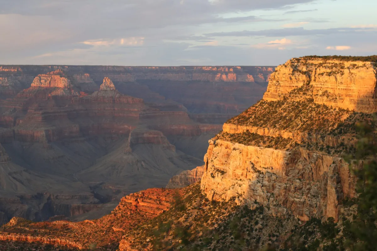
Visiting the Grand Canyon in 2026 is different: international visitors pay an extra $100 each, in-park South Rim hotels have paused overnight stays, Phantom Ranch is closed, and the North Rim is day-use only. This guide covers which rim to choose, how to save on fees, how to drive there, where to stay and get gas, both scenic drives, sunrise and sunset spots, where to turn back on a hike, and 1–3 day itineraries.
Key facts
- Entrance (per car, 7 days)
- $35 + $100 per non-US resident
- How to save
- Visiting 2+ parks: get the $250 non-resident annual pass
- From Las Vegas
- About 280 miles, 4.5–5 hours
- Lodging
- In-park South Rim hotels paused; stay in Tusayan or Williams
- Gas
- Only one station in the park, near the East Entrance; fill up in Tusayan
- EV fast charging
- Only in Tusayan outside the South Entrance (Tesla 12 stalls, EA 6)

▶ Watch the video · YouTube
South Rim, North Rim, or West Rim? Know Which Grand Canyon You're Going To
A lot of first-time planners get confused by one question: where exactly is the Grand Canyon? Well, there are actually at least three completely different places. The South Rim is our main focus today. It's open year-round and has the most to see. For a first visit, most people should start here.
The North Rim is on the other side of the canyon. It's higher up, with way fewer people. But driving there from the South Rim takes about four and a half hours. And it's usually only open from mid-May to late November; in winter, the whole road is closed. Last year, the North Rim's nearly century-old Grand Canyon Lodge was also destroyed by a wildfire.
Then there's the West Rim, the one with the glass Skywalk. It's actually not part of the national park. It's run by the Hualapai Tribe on their own reservation. It's about a five-hour drive from the South Rim, and the tickets and rules are totally different from the national park.
A lot of day trips out of Las Vegas actually go to the West Rim. So before you book anything, make sure you know which one you're really going to.
Once you've settled on the South Rim, let's talk seasons. The South Rim sits at about 2,100 meters. Summer days are pretty comfortable, but temperatures swing a lot between morning and evening. In winter it snows and the roads ice over, so come ready with traction gear and warm layers.
July through early September is monsoon season. Afternoon thunderstorms are common, and flash floods can hit inside the canyon. A flash flood in late August this year changed lodging across the entire South Rim.
Big Changes in 2026: Park Hotels Paused, Canyon Floor Closed
As of early November 2026, there are a few big changes at the Grand Canyon. First, starting August 31, all the hotels inside the park on the South Rim stopped overnight stays. That includes El Tovar, Bright Angel Lodge, Maswik Lodge, and Yavapai Lodge.
So why did this happen? A flash flood on August 29 damaged the water pipeline in the canyon. Because of that, the park went to Stage 4 water restrictions.
Here's the latest from the company that runs El Tovar and four other hotels, as of October 28. The pause has been extended to November 19, and bookings from the 20th on are, for now, going ahead as normal. Yavapai Lodge still hasn't announced a reopening date. These dates have been pushed back several times, so check the official website again before you go.
Second, Phantom Ranch at the bottom of the canyon is closed. The operator says it'll stay closed until at least January 31, 2027. The trails down into the canyon have only partly reopened, and the water stations along the way are all shut off; only the trailheads still have water. If you're hiking down, bring all the water you need.
Third, the North Rim did reopen this year, but for day use only. It's open until November 30, or until the first big snowfall. There's no lodging inside the park, no campground, no drinking water, no food service, and the gas station is closed too. If you're going to the North Rim, fill up your tank ahead of time at Jacob Lake.
The good news? On the South Rim, the scenic drives, viewpoints, and shuttle buses are all running as usual. If you're visiting during the day, you'll barely notice; you'll just need to find a place to stay outside the park. Which town works best? More on that in Chapter 5.
Fees and Entrances: How to Win Back That Extra $100
First up, the entrance fee. The Grand Canyon charges per vehicle: $35 for a private car, and that covers everyone inside, up to a 15-passenger van. It's good for seven days.
Starting January 1, 2026, there's a new rule. Non-U.S. residents age 16 and up pay an extra $100 surcharge per person, on top of the entrance fee. Two non-U.S. residents in one car: that's 35 plus 200, for a total of $235.
There's a way to win that money back. Get the $250 non-resident annual pass. That way, the surcharge is waived for everyone in the same car. This pass works at every national park in the U.S. for a full year. And at places that charge per person, it covers the pass holder plus three adults.
So if your U.S. trip includes two or more national parks that charge the surcharge, say, the Grand Canyon plus Zion, the annual pass is pretty much always the better deal.
Also, park entrances now only take credit and debit cards. No cash, so bring your card. According to the park, during spring break and summer, from 9:30 a.m. to 4 p.m., the wait at the South Entrance can reach two hours. Get in before 9:30 a.m., or after 4 p.m., and it's way easier.
Driving In: Two Main Routes, Plus Three Stops Worth Making
Let's start from Las Vegas. Take US 93 to Kingman, then hop on I-40 east to Williams. From there, take Highway 64 north. It's about 280 miles total, around 450 kilometers. That's a four-and-a-half to five-hour drive.
Coming from Phoenix, take I-17 to Flagstaff. Then take I-40 west to Williams and switch to Highway 64. It's about 230 miles total, around three and a half to four hours behind the wheel.
Another option is coming from Page and Horseshoe Bend, passing through Cameron, and entering at the East Entrance. Then you follow Highway 64 west the whole way, and your first stop is the Desert View Watchtower.
Now for the stops along the way. Head southeast out of Las Vegas for about 30 miles, around 40 minutes, and you'll reach Hoover Dam. But here's the thing: the highway actually crosses on the bypass bridge, downstream from the dam.
The bridge has tall barriers on both sides, so you basically can't see the dam as you drive across. If you want to see it, take Exit 2 and make a short detour. Plan on about an hour to park and take photos.
Past Kingman, old Route 66 splits off from I-40. The old road loops way up north and rejoins near Seligman. Seligman goes by the title "Birthplace of Historic Route 66." Old gas stations and vintage signs: just about any photo you take here looks great.
Keep heading east and you'll hit Williams. If you'd rather not drive into the park yourself, there's a scenic train here. It runs to Grand Canyon Village every day except Christmas. It's about 2 hours and 15 minutes each way, you get a little over three hours at the South Rim, and you ride back in the afternoon.
Watch out for time zones on the road, too. Arizona doesn't observe daylight saving time. So in winter, driving in from Las Vegas, you'll set your watch forward one hour. In summer, both sides are on the same time.
But the Navajo Nation does observe daylight saving time. So if you're heading to the Antelope Canyon area, always go by the time your tour company gives you, not the Arizona time on your phone.
Can't Stay in the Park? Where to Sleep, Eat, Get Gas, and Charge
The closest option outside the park is the little town of Tusayan, right outside the South Entrance, just 7 miles from the Village. Its hotels are all open as usual and aren't affected by the park's water restrictions.
A bit farther out, Valle is about 30 miles away, Williams 60 miles, and Flagstaff 80 miles. If you're on a budget, Williams and Flagstaff have the most options, and better prices too.
From Williams, it's only an hour to the South Entrance. From Flagstaff, it's about an hour and a half. If you're coming from Las Vegas, spend the night before in Williams or Tusayan, then head into the park first thing the next morning. That way you'll wait less in line and catch the morning light.
If you want to camp, Mather Campground is open year-round. But right now, only sites without water or electric hookups are available, and campfires are banned. The RV park, Trailer Village, is closed because of the water restrictions, and Desert View Campground is already closed for the season.
As for food, some restaurants in the park are temporarily closed. The coffee bar and restaurant at Bright Angel Lodge, plus the market in the Village, are still open. But they're all on shorter hours. Your safest bet is to keep water and snacks in the car.
Gas is where a lot of people run into trouble. There's only one gas station in the South Rim part of the park, near the East Entrance, around the Desert View Watchtower. It's open 24 hours, pay-at-the-pump by card. There isn't one in the Village.
So fill up in Tusayan before you go in. If you're coming in through the East Entrance, fill up in Cameron. And once you leave through the East Entrance, it's about another 30 miles to Cameron before the next gas station.
Driving an EV? Plan your charging ahead of time. Inside the park there are only free Level 2 chargers, at Yavapai Lodge East and a few spots around Maswik Lodge, and only Yavapai Lodge has Tesla connectors. There's no fast charging in the park, and none at Desert View or the North Rim.
For fast charging, go to Tusayan, just outside the South Entrance. There's a Tesla Supercharger by The Grand Hotel with 12 stalls, up to 150 kilowatts. The Grand Canyon Visitor Center outside the gate also has an Electrify America station with 6 chargers, up to 350 kilowatts. Charging up there before you enter is the safest bet.
Be careful on the drive out through the East Entrance. Cameron has no fast charger right now. From the village, out the East Entrance to Page, it's about 140 miles, and Page has the next Tesla Supercharger. Cold weather cuts your range in winter, so top up a little extra in Tusayan before you go.
Your First Hour in the Park: Where to Go, Where to Park, Which Shuttle to Take
Once you're through the South Entrance, most people's first stop is Mather Point, the one right next to the Visitor Center. For a lot of people, that jaw-dropping first look happens right here.
Park in Visitor Center Lots 1 through 4. Lot 1 is the closest to Mather Point, and it's the only one of the four with spaces for RVs and trailers. In peak season, get there before 10 a.m. and you can usually find a spot. Any later and it fills up fast.
If it's full, head to Lot D in the Village, next to the Backcountry Information Center. It's big and often still has spaces. And it's an easy walk to the Red Route shuttle stop and the Bright Angel Trailhead.
These lots are huge, so make a note of your section's number and sign, or just snap a photo. Cell signal is weak in parts of the park, so download offline maps ahead of time. Don't rely entirely on your GPS.
The free shuttle buses are highly recommended. The South Rim has three routes right now. The Blue Route loops around the Village, connecting the Visitor Center, hotels, campgrounds, and the market. The Orange Route heads east to Yaki Point and the South Kaibab Trailhead; you can't drive your own car to Yaki Point. The Red Route is Hermit Road, and I'll cover that in the next chapter.
The fall schedule runs through November 30. The Blue Route runs from 7 a.m. to 9 p.m., and the Orange and Red Routes run until one hour after sunset. The winter schedule starts in December, so check the park website then. Remember that last-bus time. It'll come in handy in the sunset chapter.
Two Scenic Drives: Ride the Red Route West, Drive Yourself East
First up, Hermit Road. It's on the west side of the South Rim, running from the Village all the way to Hermits Rest, about 7 miles, or 11 kilometers. Every year from March 1 to November 30, private cars aren't allowed on it.
During that time, your only option is the free Red Route shuttle. Only from December through February can private vehicles under 22 feet long drive it themselves.
There are nine viewpoints along the Red Route. On the way out, it stops at every one. On the way back, it only stops at Hermits Rest, Pima Point, Mohave Point, and Powell Point. If you never get off, the round trip takes about 80 minutes.
Pima Point is pretty quiet. If you're lucky, you can hear the Colorado River way down at the bottom of the canyon. You can also hop off along the Red Route, walk a stretch of the Rim Trail, then hop back on.
On the east side of the South Rim is Desert View Drive. From the Village to the East Entrance, it's 23 miles long, about 37 kilometers. You can drive it in your own car, and it's open pretty much year-round.
There are six official viewpoints along the way. Going west to east, first is Pipe Creek Vista: lots of people, not many parking spots. Next is Duck on a Rock. Then Grandview Point, with a super wide-open view. Farther east is Moran Point, where the rock layers have the most beautiful colors.
Near the end, there's also Tusayan Ruin. It shares its name with the town outside the South Entrance, but it's an ancient Ancestral Puebloan village. It's usually open April through October, and this year it already closed at the end of October. Also, Lipan Point is under repair this year, closed from June 22 all the way to December 23.
The end of the road is the Desert View Watchtower. To go up to the top, you'll need to grab a free ticket first, with up to 25 people at a time. The last group goes up at 4 p.m. Whether the upper floors are open depends on staffing. Right next door, Navajo Point is the highest viewpoint on the entire South Rim.
Sunrise and Sunset: Which Spot, and How Early to Get There
Which spot you pick for sunrise or sunset, and when you show up, makes a big difference. For sunrise, the park recommends Mather Point or Yaki Point. Mather Point is right next to the Visitor Center, so you can just drive there yourself.
To get to Yaki Point, take the Orange Route; in fall, the first bus leaves at 6 a.m. Make sure you arrive 30 minutes before sunrise, and ideally stick around for about an hour after. Mornings up on the plateau are cold, so bring an extra layer.
For sunset, let's start on the west side. Hopi Point and Mohave Point on Hermit Road are the most popular spots for sunrise and sunset. Hopi Point gets the biggest crowds, so if you want it quieter, go to Mohave Point or Pima Point. The last Red Route bus leaves an hour after sunset, so no need to worry about getting back.
Now the east side. Along Desert View Drive, Yaki Point, Navajo Point, and the Desert View Watchtower all have wide-open views to both the east and west, great for sunrise and sunset.
If you're driving yourself, trust me, save Desert View Drive for the late afternoon. Drive east the whole way, catch the sunset at the Watchtower, and then head straight out the East Entrance.
Half an hour before sunset, parking at the popular viewpoints is often hard to find. The park suggests arriving up to 90 minutes early, and sticking around at least 10 minutes after sunset.
Summer evenings often bring thunderstorms. If you see lightning and hear thunder less than 30 seconds later, get back to your car or indoors right away. And if you've got half a day left and don't want to hike hard, the trail in the next chapter is perfect for you.
South Rim Village Walks: Easy Enough for Seniors and Kids
The Rim Trail on the South Rim is about 21 kilometers long, and it's mostly paved. But you don't need to walk the whole thing. Just pick two sections, and that's plenty.
Section one: Mather Point to the Yavapai Geology Museum. It's about 1 kilometer, 15 to 30 minutes. It's paved, with just a few short slopes. The museum is currently open every day from 8 a.m. to 6 p.m.
Section two: from the Geology Museum west to the historic Village. This stretch is called the Trail of Time. It's about 2.1 kilometers, fully paved and accessible. Every meter you walk represents one million years of the canyon's geologic history. It takes about an hour to walk.
Walking all the way from Mather Point to the Village is about 4 kilometers, 45 minutes to two hours. Going east to west, it's mostly downhill. So I'd suggest walking west, and when you get tired, take the Blue Route back to the Visitor Center.
If you're traveling with older folks, keep in mind: at over 2,000 meters, with dry air, a lot of people get headaches and feel thirsty. Drink plenty of water or electrolyte drinks, take it slow, and don't hit the trails as soon as you arrive.
Every shuttle bus can take wheelchairs, but very large power wheelchairs might not fit. If you have limited mobility, you can request a Scenic Drive Accessibility Permit at the entrance or the Visitor Center.
With it, you can drive into some sections that are closed to private cars. Along Hermit Road, the only accessible stretch of trail is the section from Monument Creek Vista to Pima Point.
If you've got kids, you can pick up a Junior Ranger booklet at the park bookstore. Complete the activities, and they earn a badge. On the Rim Trail, always keep a firm hold on your kids. The park requires staying at least 2 meters from the edge, and wherever there's a railing, never climb over it.
Here's a surprise: the animal that injures the most visitors in the park is the rock squirrel. Don't feed them. Feeding wildlife is illegal. Stay at least 23 meters from elk and deer, about the length of two buses. And when you're driving at dawn or dusk, watch for animals on the road.
Hiking Into the Canyon: Where You Have to Turn Back
Now, about that mistake people make every year that I mentioned at the start: hiking too far down, and then having a really hard time getting back up. Remember this: going down is easy, coming back up is hard. The park's advice is to plan on twice as much time for the climb up as for the hike down.
For your first hike into the canyon, I recommend the South Kaibab Trail. The trailhead is on the Orange Route, so the shuttle is the easiest way to get there. 0.9 miles down, about 1.4 kilometers, there's a spot called Ooh Aah Point. The view there is already incredible.
Keep going down to the 1.5-mile mark, about 2.4 kilometers, and you'll reach Cedar Ridge. There are restrooms here, but no water. The park says this is a good place to turn around. It's ideal if it's your first time hiking into the canyon, if you're just out for a casual walk, or if you got a late start.
Farther down, at 3 miles, is Skeleton Point, where you get your first view of the Colorado River. But the park is very clear: on a day hike, don't go past this point. So here's the answer to the question from the start: on your first visit, turn around at Cedar Ridge, and never go past Skeleton Point.
This trail has no water the entire way, and very little shade. And this year, the water stations along the Bright Angel Trail are all shut off too. Whichever trail you take, bring plenty of water and some salty snacks.
The park also has two key warnings. First, don't try to hike from the rim to the river and back in a single day, especially from May to September. Second, from May to September, try not to be hiking in the canyon between 10 a.m. and 4 p.m.
When you're hiking as a group, let the person with the least stamina set the pace. If something goes wrong in the canyon, you often have to help yourself first, because rescue may not get there right away. This year, a lot of trail sections are open while repairs are still going on, so before you head out, check the park's trail alerts one more time.
Just Follow Along: One-, Two-, and Three-Day Itineraries
Finally, here are three itineraries you can just copy. If you only have one day, leave Williams before 7 a.m. and get through the South Entrance by 8. Start at Mather Point, then take the Red Route along Hermit Road, and head back to the Village for lunch.
In the afternoon, drive east along Desert View Drive, catch the sunset at the Desert View Watchtower, and exit through the East Entrance. If you're heading back to Williams that night, you'll have to loop back through Cameron and Flagstaff, about two hours of driving in the dark.
If you have two days, arrive on the afternoon of day one, take the Red Route to Hopi Point for sunset, and stay in Tusayan that night. First thing on day two, take the Orange Route to Yaki Point for sunrise.
On the way, hike a stretch of the South Kaibab Trail down to Ooh Aah Point. Then head east along Desert View Drive, and once you're out the East Entrance, it's about a two-hour drive to Page. Catch Horseshoe Bend in the evening and spend the night in Page.
If you have three days, build on the two-day plan: on the morning of day three, see Antelope Canyon in Page. You can only go in with a Navajo-guided tour, so book ahead. Or, if the North Rim is still open, head west from Page through Jacob Lake to the North Rim. Keep going northwest, and you're at Zion.
General information only. Rules change; check official notices before you go.
Video chapters
- 0:00 Intro: Two People, $235 Just to Get In
- 1:00 South Rim, North Rim, or West Rim? Know Which Grand Canyon You're Going To
- 2:39 Big Changes in 2026: Park Hotels Paused, Canyon Floor Closed
- 4:32 Fees and Entrances: How to Win Back That Extra $100
- 5:54 Driving In: Two Main Routes, Plus Three Stops Worth Making
- 8:09 Can't Stay in the Park? Where to Sleep, Eat, and Get Gas
- 9:55 Your First Hour in the Park: Where to Go, Where to Park, Which Shuttle to Take
- 11:35 Two Scenic Drives: Ride the Red Route West, Drive Yourself East
- 13:49 Sunrise and Sunset: Which Spot, and How Early to Get There
- 15:35 South Rim Village Walks: Easy Enough for Seniors and Kids
- 17:52 Hiking Into the Canyon: Where You Have to Turn Back
- 19:56 Just Follow Along: One-, Two-, and Three-Day Itineraries
Routes, parking and gas stations, shown on maps and real footage, one section at a time.